Nevada Statewide Maps
WARNING: File sizes can be large - we suggest you download the files rather than opening them through your browser (ie, right click and save link or target).
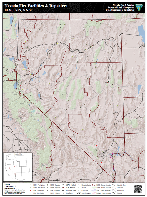
Facilities and repeaters used throughout Nevada for wildland fire operations by the Bureau of Land Management, Humboldt-Toiyabe National Forest, and the Nevada Division of Forestry. Facilities include: fire stations, district/state offices, air tanker bases, seat bases, helitack bases, and dispatch centers. Also included on the map are repeater locations, RAWS locations, BLM district boundaries, USFS administrative boundaries, and military base boundaries.
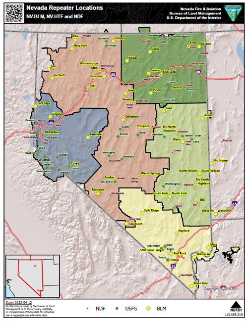
Federal and state repeaters used throughout Nevada for wildland fire operations.
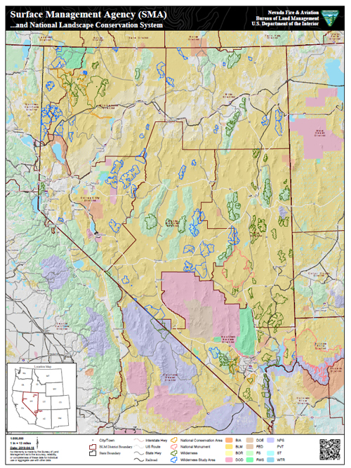
The Surface Management Agency (SMA) depicts Federal land for the United States and classifies this land by its active Federal surface managing agency. A Federal SMA agency refers to a Federal agency with administrative jurisdiction over the surface of Federal lands. Jurisdiction over the land is defined when the land is either: Withdrawn by some administrative or legislative action, or Acquired or Exchanged by a Federal Agency. This map is a dynamic assembly of spatial data layers maintained at various federal and local government offices. The spatial data displayed in this map represents the polygon features that show the boundaries for Surface Management Agency and the surface extent of each Federal agency’s surface administrative jurisdiction. SMA data depicts current withdrawn areas for a particular agency and (when appropriate) includes land that was acquired or exchanged and is located outside of a withdrawal area for that agency. The SMA data do not illustrate land status ownership pattern boundaries or contain land ownership attribute details.
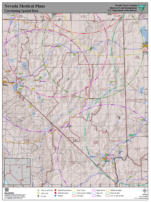
This map is based on three spatial layers that are pertinent to the Nevada BLM, district medical plans.
- Regional rotor wing (helicopter) coverage based on one fuel cycle (150 mile radius) in and around the state of Nevada. These data are based on medically capable helicopters only.
- Regional medical facilities in and around the state of Nevada. The medical facilities are classified by facility type (Medical, Medical/Trauma, & Medial/Trauma/Burn).
- Location of airports around the state of Nevada. The airports are classified by the fuel available at each airport (100LL & Jet A, 100LL Only, and No Fuel). All airports are labeled by airport name as well as the 3-character airport identifier.
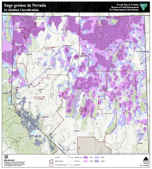
Sage grouse management areas throughout Nevada and eastern California. Included are the Greater Sage grouse and the Bi-State Sage grouse as well as Sagebrush Focal Areas (SFA).
The Sagebrush Focal Areas are an outline of the USFWS Areas of Significance for GRSG. Created by the USFWS. Edits made by the BLM under the direct supervision of the USFWS in Feb 2015.
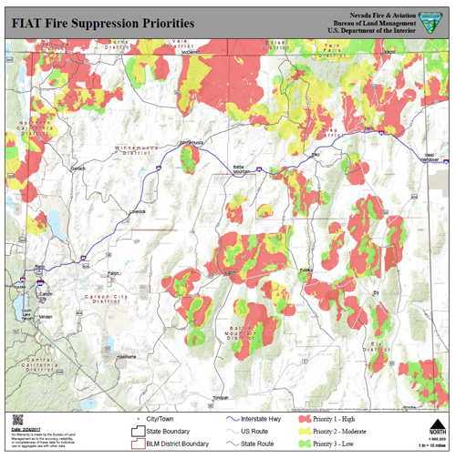
Fire Operations Priority Area polygons are delineated by initial attack priority areas, resource pre-positioning and staging priorities, areas where opportunities exist to enhance or improve suppression capability, and identify areas where wildfire can be managed to achieve land use plan and COT objectives. Fire operations management strategies are preparedness, prevention, and suppression. The data are broken down into three priority levels: priority 1 (high), priority 2 (moderate) and priority 3 (low).